Geospatial Research
The Geospatial Research at The Takshashila Institution applies the principles of mapping and spatial analysis to understand real-world problems.
What We Do?
The geospatial analysis and research sector has emerged as a transformative force in various industries. Utilizing cutting-edge technologies such as GIS (Geographic Information Systems) and remote sensing, it enables professionals to study and interpret spatial data to make informed decisions. From urban planning and environmental management to disaster response and market analysis, geospatial analysis plays a crucial role. Continuous advancements in satellite imagery, artificial intelligence, and data analytics have further accelerated the sector's growth, especially for open-source intelligence.
Subscribe to Our Newsletter
Latest Research
Latest Commentary
By Rakshith Shetty and Keerthi Shree
Mapping of Wildfire using Remotely Sensed Data: Case Study of Los Angeles
By Keerthi Shree
Our Opinion in the Media
Maps Snaps
Geospatial Snapshots Focused on India's Interests
Latest Videos
Is it time that India crafts a new China policy in 2025, to counter China’s Wolf Warrior Diplomacy? TNIE Senior Journalist Neena Gopal talks to China experts Dr Y. Nithiyanandam and Dr Jabin T Jacob to find out in this exclusive interview.
Watch Y Nithiyanandam, Professor and Head of the Geospatial Research Programme at Takshashila Institution in conversation with Rishika Singh, The India Express discussing the lack of official data sharing between China and downstream countries like India and Bangladesh, which complicates assessing the project's potential impacts.
Head Geospatial Researcher at Takshashila, Bengaluru, Professor Y Nithiyanandam examining China’s super dam project on Yarlung-tsangpo, its ecological impact, and India’s strategic
Dr. Nithiyanandam, Professor and Head, Geospatial Program at the Takshashila Institution talked about the Transformative role of Geospatial technology in China’s development.
Head Geospatial Researcher at Takshashila, Bengaluru and former NASA AERONET Station manager, Professor Y Nithiyanandam explains the main reasons behind the Delhi Pollution situation and gives his opinions on how to solve the crisis.
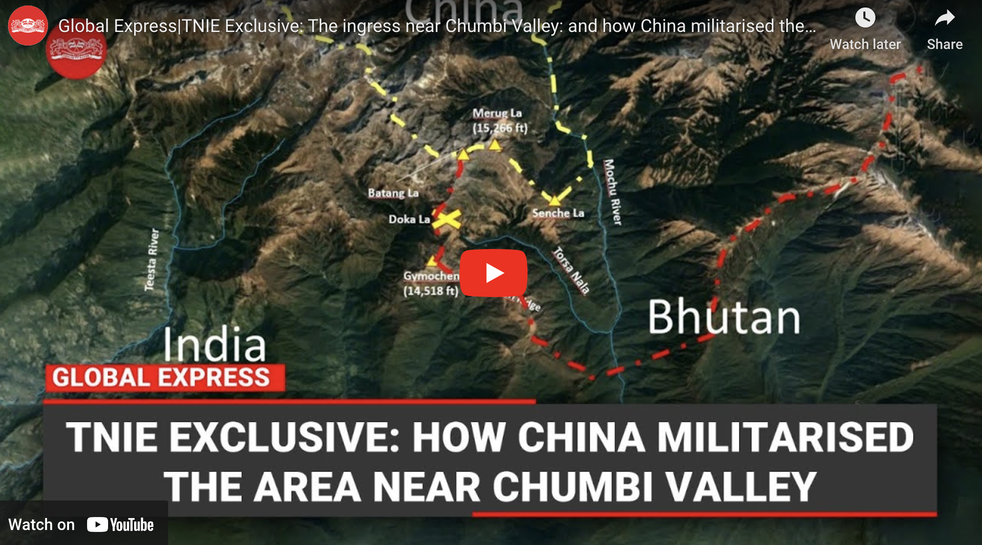
Senior Journalist Neena Gopal is in discussion with Dr Nithiyanandan, Head of the Geospatial Research Program at Takshasila Institution. Unveiling the Dragon’s footprint today is Dr Y. Nithiyanandam of Takshashila Institution, who has tracked Chinese intrusions upto 9 km inside Bhutanese territory along the MOCHU River in the Doklam Plateau.
In this video, Prof Nithiyanandam, Professor and the Head of the Takshashila Institution's Geospatial Program, explains China’s People Liberation Armey’s presence in the Doklam region from 2017-2023, using geospatial imagery and data.
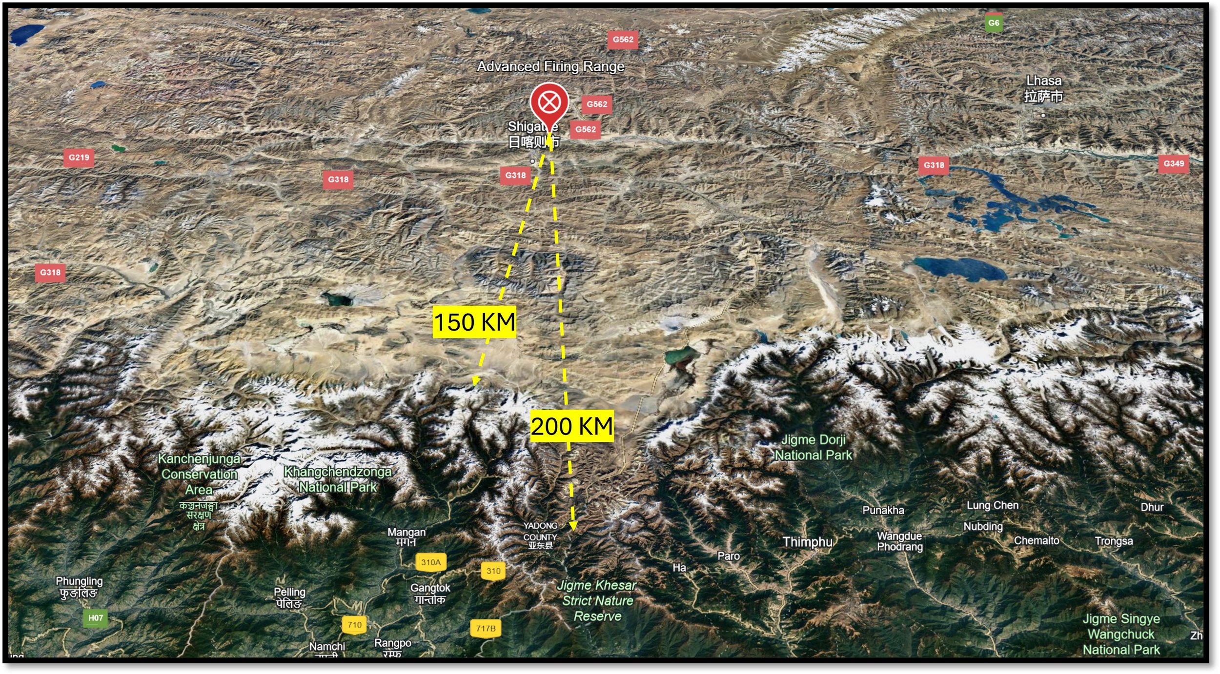
In this video, Prof Nithiyanandam, Professor and the Head of the Takshashila Institution's Geospatial Program, discusses Chinese airpower expansion in Tibet, close to the Indian borders.
In this video, Prof Nithiyanandam, Professor and the Head of the Takshashila Institution's Geospatial Program, discusses China’s radar surveillance attempt in Tibet.
In a video for Global Express, Lt. Gen. Prakash Menon (Head, Strategic Affairs Programme, Takshashila) and Dr. Y Nithiyanandam (Head, Geospatial Research Programme, Takshashila), discuss with Ashok Kantha, Former Ambassador to China and senior journalist Neena Gopal, China’ latest cartographic aggression.
Dr Nithiyanandam, head of Takshashila’s Geospatial Programme, appeared on three TV shows on Gujarati Channel Mantavya News on August 22-23, 2023, and discussed India’s successful lunar landing and its larger scientific and strategic implications.
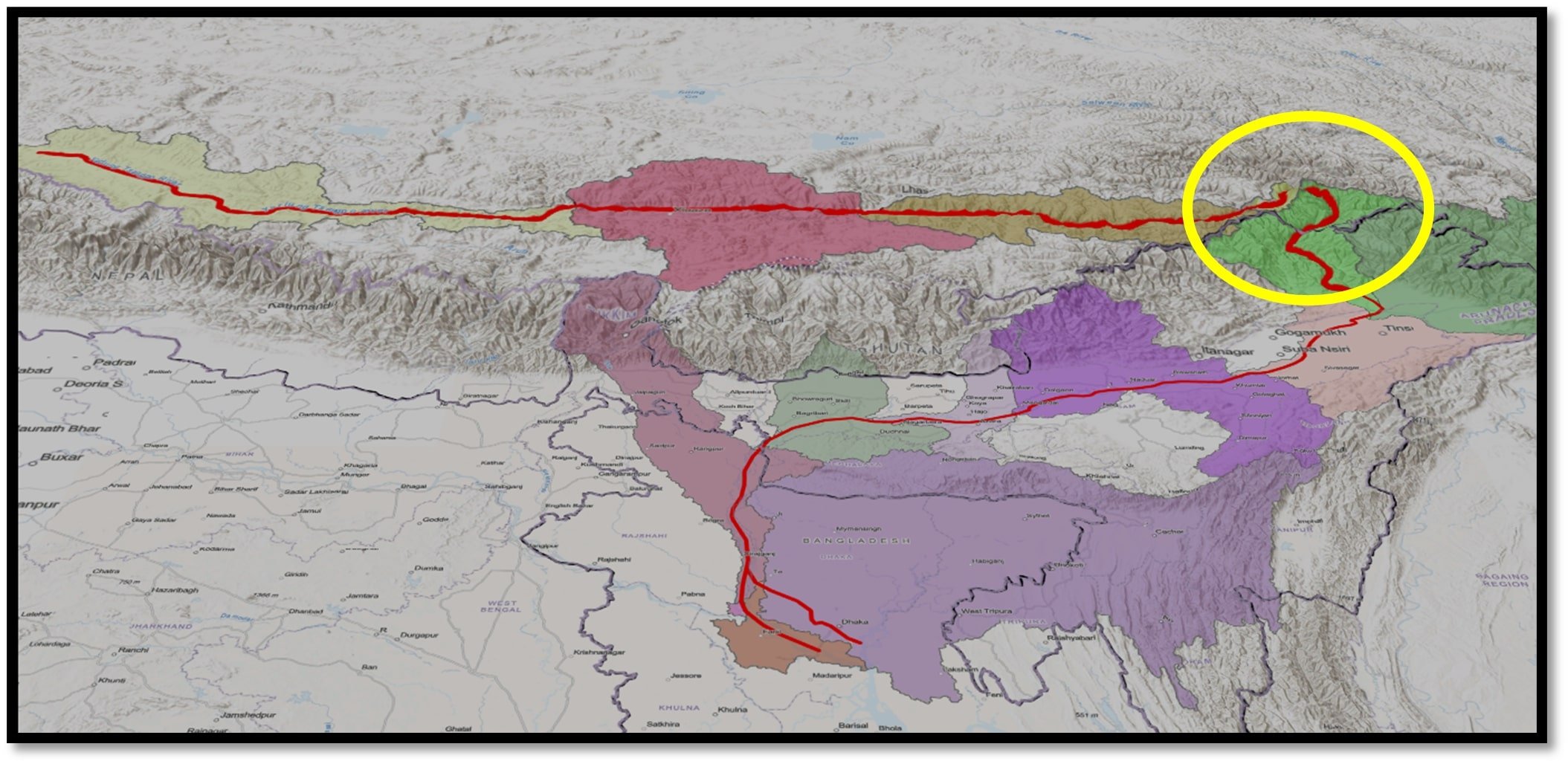
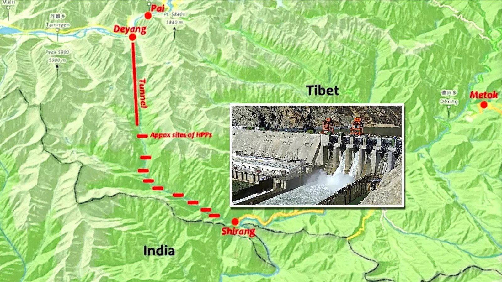
China is planning to build the world's largest dam very close to India's border. It may be used as a potential weapon against India. In this video, Prof Nithiyanandam, Professor and the Head of the Takshashila Institution's Geospatial Program, talks about the possible impact of this dam on India and Bangladesh.
Our Analysis in the Media
Team
Dr Y. Nithiyanandam is a professor and the head of the Takshashila Institution's Geospatial Program. He is working on several themes in defense and national security.
Swathi is a Research Analyst for the Geospatial program at the Takshashila Institution. Her research focuses on the significance of remote sensing and GIS technology in understanding real world problems.


